Green: overlook only
DEC page checked, road and parking usable, daylight generous, upper trail open, shoes stable, children following boundaries and no thunder, ice or high-water concern.
OSWEGO COUNTY · WATERFALL OVERLOOK · AUTHORITY-EXPANSION
The family version is the short, firm-surface overlook route. The steep gorge is not a bonus round, and the restricted cliff zone is not negotiable.
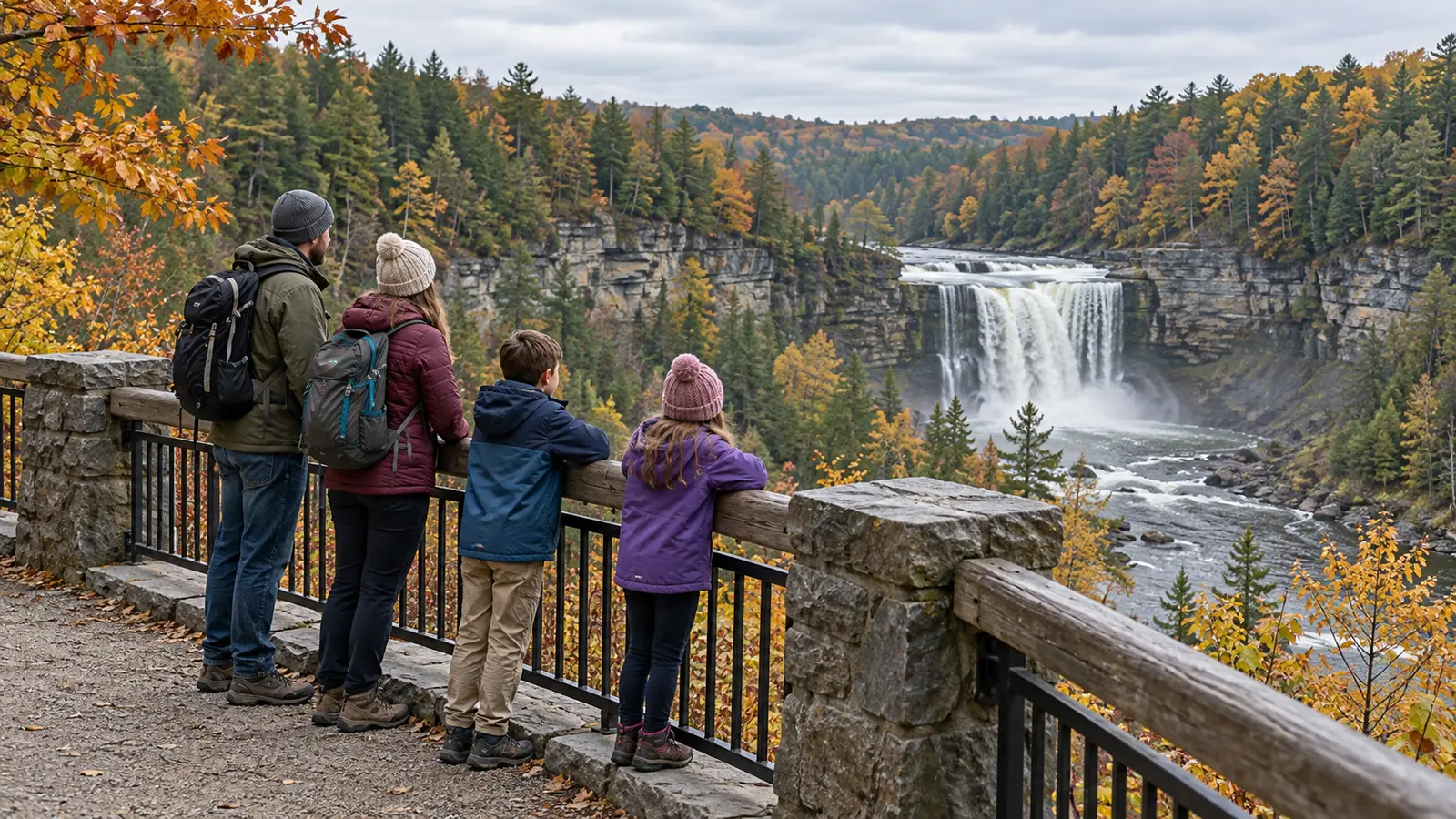
Bring school-age kids for the upper overlook, not for a gorge conquest. DEC describes a 110-foot waterfall on a 112-acre property and a 0.2-mile accessible trail from the Falls Road parking area. That short route has a firm compacted-stone surface, at least three feet of tread and a maximum listed slope of 10 percent. It gives a family a specific, finishable objective without pretending a steep descent is required.
DEC also says the 600-foot Gorge Trail is steep and demanding, with two stair sections, and suited only to the physically fit. For this family plan, skip it even when it is legally open. The same answer applies to the River Bed Trail. A spectacular view does not improve when an adult is managing tired children on steep stairs near a gorge. Families wanting a longer but lower-consequence outing can compare the Old Erie Canal out-and-back; families choosing among waterfalls can use the Central New York trail picker.
The route may take less time. That is fine. This is a waterfall look, not a mileage badge. If the parking area or first viewing point is crowded, wait in a safe place or leave; never create a second trail beside the trail.
DEC lists the property fee as free and the Falls Road parking area near the Town of Orwell in Oswego County. Free does not mean staffed, reserved or guaranteed. Arrive with enough fuel, download directions before cell service becomes uncertain, and use DEC’s coordinates rather than relying on a business name. Budget roughly 75 to 90 minutes of drive time from central Syracuse under normal conditions, then verify the actual route and traffic on the day. Snow, construction and rural-road conditions can change that estimate substantially.
The official property page does not promise a restroom, potable water, food service or trash disposal. Plan as if none are available: use a restroom before the final rural leg, carry your own water and a contained snack for the car, and pack out every item. DEC says gas, food, dining and lodging may be found in Pulaski, but businesses and hours are volatile. Do not picnic near the cliff or carry glass onto the property; DEC prohibits glass containers and alcohol here.
The unique area closes from sunset to sunrise. Swimming and wading in the plunge pool are prohibited. Throwing anything into the gorge, open fires, camping, rock climbing and unauthorized motor vehicles are prohibited. The site is carry-in, carry-out. Treat these as trip design, not fine print: arrive early enough to be back at the car well before sunset, leave rocks where they are, and do not use the waterfall as a swimming stop.
DEC says pets should be under control and leashed while other forest users are around. A leash is not protection from a cliff, crowd or hot/cold vehicle. Bring a pet only when one adult can manage it without weakening child supervision, and pack waste out. Confirm any service-animal or access question directly with DEC Region 7 rather than relying on this guide.
DEC specifically lists the 0.2-mile Salmon River Falls Accessible Trail from the Falls Road parking area with a firm compacted-stone surface, minimum width of three feet and maximum slope of 10 percent. That is useful evidence, not a promise that today’s surface, snow, drainage, parking transfer or every viewing position works for every device. Call DEC Region 7 at the number on the property page about current surface, barriers, rest areas, parking configuration and assistance needs.
A sturdy all-terrain stroller may handle a firm surface better than a small-wheeled travel stroller, but the manufacturer limits and current trail conditions control. Never use a stroller brake as cliff protection. Keep hands on the stroller near viewing areas, secure the child as instructed, and turn around for mud, ice, deep leaves, crowding or a route narrower than the device can safely pass. The outing load calculator can prevent a short walk from turning into an overpacked haul.
Check the National Weather Service forecast and radar before leaving and again when service permits. Thunder ends the overlook plan; do not wait under a tree or at a railing to see if it passes. Freezing rain, snow-covered edges, strong wind, heavy rain, poor visibility or a road advisory also means cancel. Water releases and rain can change river conditions quickly. A dramatic flow is never permission to cross a closure or approach the gorge.
From November 15 through May 1, DEC closes the Gorge Trail and River Bed Trail; only registered ice climbers may use the Gorge Trail during winter under the separate rules. That does not turn the upper overlook into a guaranteed winter family walk. Use the family weather cutoff, check the property page, and choose a different plan when ice or plowing is uncertain.
Bring grippy closed-toe footwear, simple weather layers, water, a familiar car snack, a downloaded map, a fully charged phone, any required medication managed by the responsible adult and a compact first-aid kit whose contents an adult understands. Add dry socks and a towel after rain. In colder weather, use the family’s proven hat, gloves and insulation system. Leave glass, alcohol, loose balls, drones unless explicitly authorized, and any prop that tempts a child toward the edge.
Do not buy waterfall gear to rescue a poor forecast. A familiar daypack and shoes that already fit are better than untested equipment. Use the family day-trip system for the broader car and contact plan, then keep the trail load small.
Bad weather: cancel before the rural drive and choose an indoor plan; do not substitute a wet gorge walk. Low energy: walk only to the first usable observation area, spend five minutes, and return. Crowded: skip the photo, protect the travel lane and leave when supervision gets harder. Meltdown: move away from edges and other visitors, lower demands, return to the car and end the visit. The child does not owe the family a second attempt that day.
Skip today if a child runs from adults, treats barriers as a challenge, needs an unconfirmed restroom or mobility feature, lacks stable footwear, or cannot tolerate the drive-to-walk ratio. Also skip for anyone expecting gorge access, swimming, a playground, food service or a long hike. The upper overlook is the point. Families ready to accept that constraint are the families most likely to finish well.
Reviewed October 27, 2026 using the New York State Department of Environmental Conservation’s property description, accessibility details, directions and site-specific rules and official map. The upper-trail-only family route and decision card are independent editorial planning, not an official itinerary, access determination or statement of live conditions. No affiliate links are attached. Report corrections through About.
MAKE THE WEEK COUNT
Build the plan your family can finish well, then leave enough energy for the next part of the day.
More family plans